公共安全
カリフォルニア州の山火事「キャンプファイア」のドローンによるマッピング
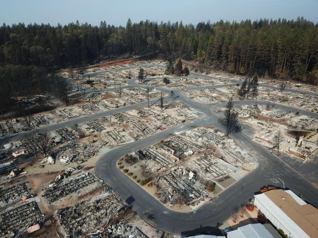
The towns of Paradise and Magalia in Northern California, nestled in the foothills of the Sierra Nevada, were once thriving communities with over 27,000 residents. On November 8th, 2018, the “Camp Fire” changed all of that within hours. Thousands have been affected by this wildfire, close to 100 people lost their lives, many thousands have lost their homes.
Over two days — hovering over the burned-out grounds of the state’s most destructive fire, a legion of drones began recording images of the devastation below in efforts to help the people who lost their homes. By the time they were done, they had collected 70,000 images over 17,000 acres resulting in 1.4 trillion pixels of data.
The detailed footage and maps would help people to determine the condition of their homes — and expedite insurance claims. The footage could also help recovery crews, demolition crews, city planners, scientists and researchers, and the general public, to get a better understanding of the situation.
The 518 coordinated flights operation, by 16 Northern California emergency responder agencies, is one of the biggest drone response to a disaster scene in the nation’s history. The 16 UAV teams were led by Alameda County Sheriff’s Office. Stockton Police, Contra Cost County Sheriff’s Office & Menlo Park Fire Protection District had the most team members present, with Union City Police, Hayward Police and Stanislaus County Sheriff’s Office providing units as well. San Francisco Police oversaw airspace mitigation. In addition to the mapping flights, over 160 full 360-degrees and interactive panoramas were created with the help of Hangar, as well as geo-referenced video was shot along major roads in Paradise through Survae. This layered data set was processed in record time.
BACK